By Ricky, on December 28th, 2009 View Larger Map
I hope that the map above will help to indicate the considerable indentation the Bay of Kotor makes to the coast of Montenegro as well as helping readers locate places mentioned in my previous post. What it also shows is the problem facing anyone wanting to drive along the coast road in a relatively straight line. – You can’t!!!
Fortunately, between Lepetane, (5 km northwest of Tivat) and Kamenari, (about 2km east of Bijela), there is a regular car ferry service across the narrowest point of the entrance channel leading into the Bay of Kotor. I gather there is a plan, at some future date, to build a bridge here. In the mean time a number of car ferries ply their way back and forth across the channel. Unless you use the ferry service, you are left with a scenic but very long and windy . . . → Read More: Taking the Ferry
By Ricky, on December 27th, 2009
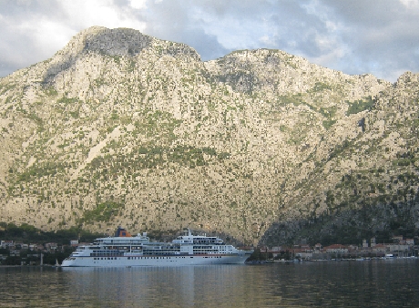
Bay of Kotor with the town of Kotor to the right of a large cruise ship © Ricky Yates
In the south-western corner of Montenegro, not far from the border with Croatia, lies the fascinating Bay of Kotor. It is often described as the most southerly fjord in Europe which the geographer in me immediately wants to dispute! Fjords are the result of glaciation whereas the Bay of Kotor is a submerged river valley. However, with the whole of the sea inlet surrounded by steep-sided mountains it is very similar in appearance to a fjord.
The historic walled town of Kotor lies at the southern extremity of the bay. As can be seen in my photograph
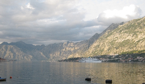
A view along the Bay of Kotor with another smaller cruise ship moored on the right. The village of Prcanj is just off the to the left of . . . → Read More: The Bay of Kotor
|
rickyyates.com is a participant in the Amazon Services LLC Associates Program, an affiliate advertising program designed to provide a means for sites to earn advertising fees by advertising and linking to Amazon.
|


Recent Comments