Exploring the River Adour in South-west France

Les Gaves Réunis, a tributary of the River Adour, at Hastingues © Ricky Yates

Two & a half months ago at the end of my post entitled ‘A Blogpost about my Blog‘, I declared that I had a couple of future posts that I intended to write. The first, about how I became a hymn book smuggler into the EU, I published a month later. However, I am unsure whether anyone has ever read it as it has attracted zero comments 🙁 Despite that, here finally, is the second promised post.

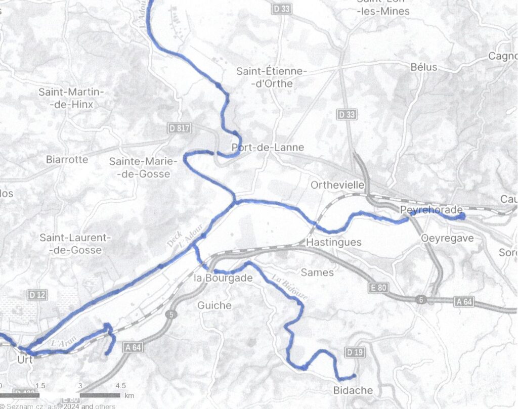
In late August/early September this year, I travelled from my home in the Czech Republic, to South-west France, for a ten-day holiday. As part of that trip, I explored the course of a river I had first discovered some thirty-eight years earlier – the River Adour. This was a further expression of my continued love of canals and inland waterways of which I have most recently written about here.

The River Adour from the Bay of Biscay to Urt

The Adour is usually navigable for some seventy kilometres from the Bay of Biscay to the city of Dax. But it has no connection to the substantial network of canals and inland waterways in the rest of France. It no longer carries commercial traffic but is used by a variety of pleasure craft. There are no locks and river levels are affected by the rise and fall of the tides.

The River Adour and Pont Henri Grenet in Bayonne © Ricky Yates

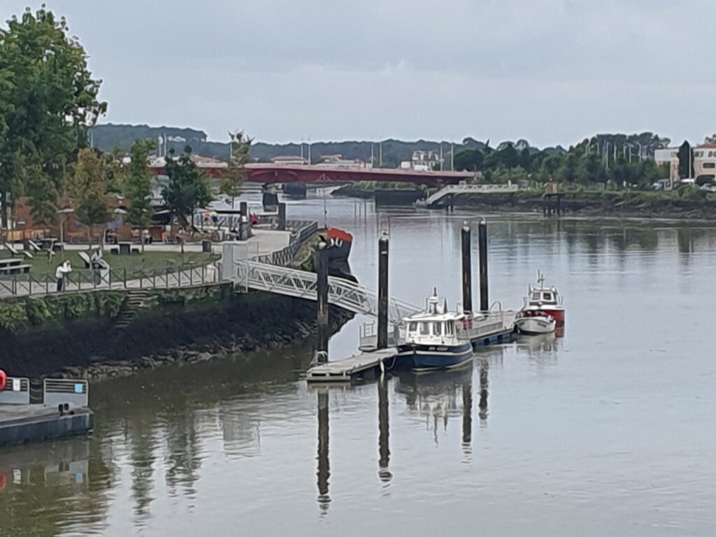
Six kilometres inland from the Atlantic coast where the Adour enters the sea, lies the city of Bayonne. Here the river is bridged for the first time by the fairly recent Pont Henri Grenet.

Pont Saint-Esprit, Bayonne © Ricky Yates

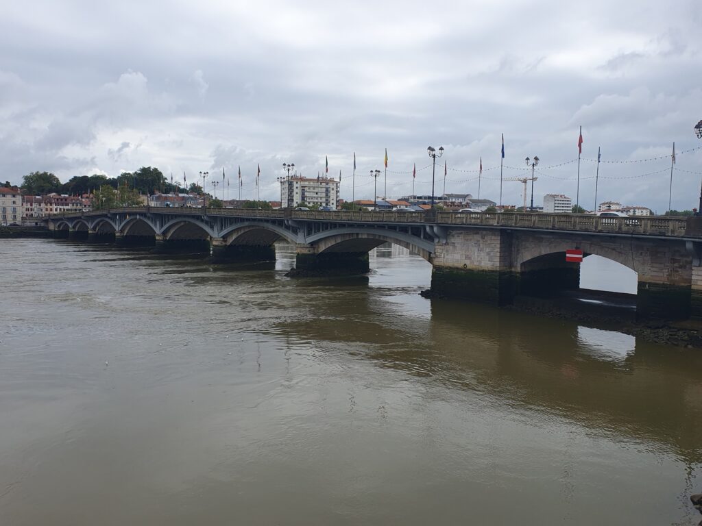
And then by the historic Pont Saint-Esprit.

After passing under another road bridge, a railway bridge and further bridge carrying the Autoroute 63, it then follows a straight and wide course eastwards, inland for sixteen kilometres, to the village of Urt.

Bridge over the River Adour at Urt © Ricky Yates

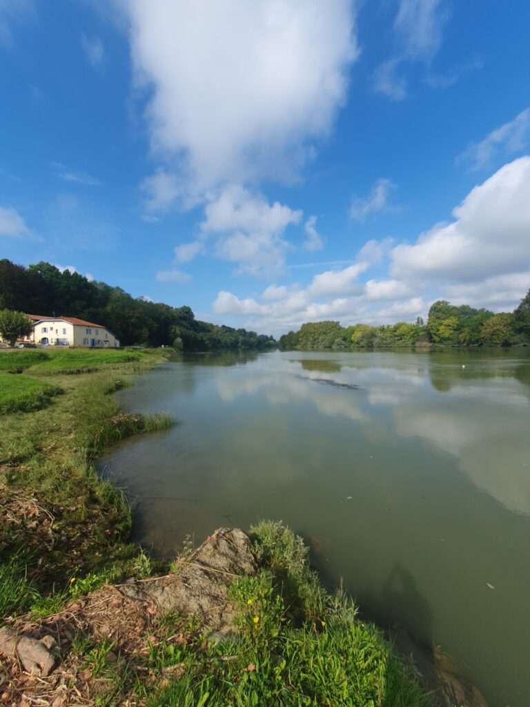
At Urt, the Adour is once more bridged and shortly afterwards, the River Aran, itself navigable for six kilometres, enters the Adour on the right bank.

The River Adour from Urt to beyond Port-de-Lanne & tributaries
The River Bidouze, on the left, entering the River Adour © Ricky Yates

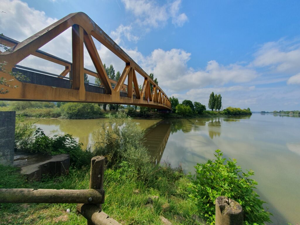
Eight kilometres further on along the Adour, the River Bidouze enters on the right bank.

Quai on the River Bidouze at Bidache © Ricky Yates

This is also navigable for about twelve kilometres to the small hilltop town of Bidache.

Bec du Gave – River Adour to the left, Les Gaves Réunis to the right © Ricky Yates

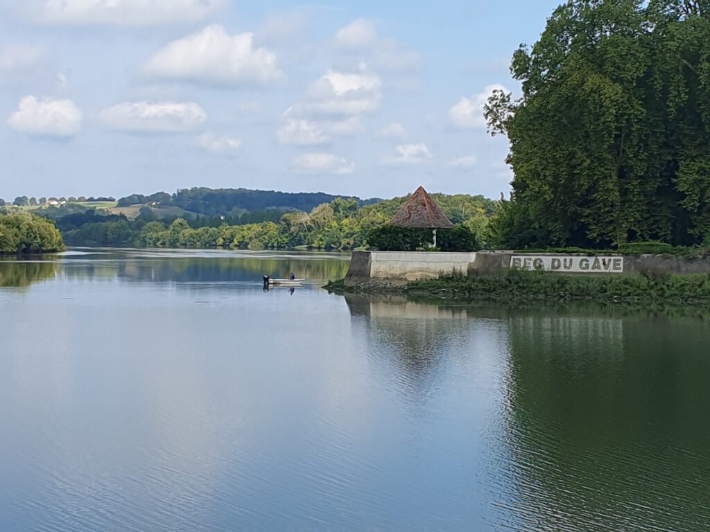
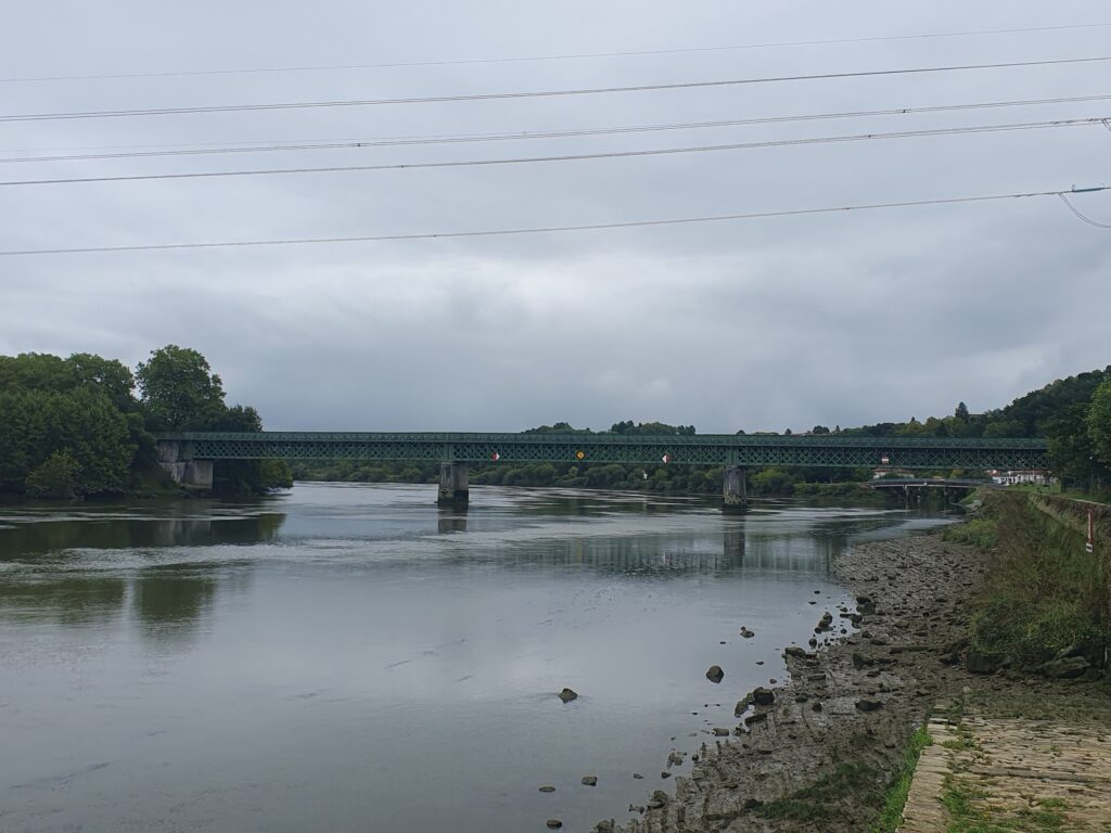
Two kilometres further on from the confluence with the River Bidouze is Bec du Gave. Here the Adour swings northward to the left, whilst on the right, continuing eastwards, is Les Gaves Réunis, navigable for nearly ten kilometres to just past the town of Peyrehorde.

Modern bridge over Les Gaves Réunis at Payrehorade © Ricky Yates

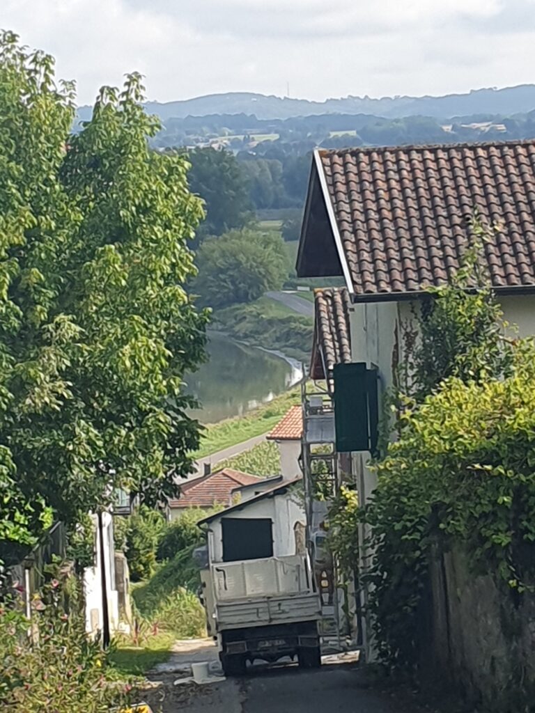
En route to Peyrehorde, Les Gaves Réunis passes the bastide village of Hastingues from where there is a lovely view down to the river, if you ignore the truck parked in the middle of the road 😉

Les Gaves Réunis from the bastide village of Hastingues © Ricky Yates
The port at Port-de-Lanne © Ricky Yates

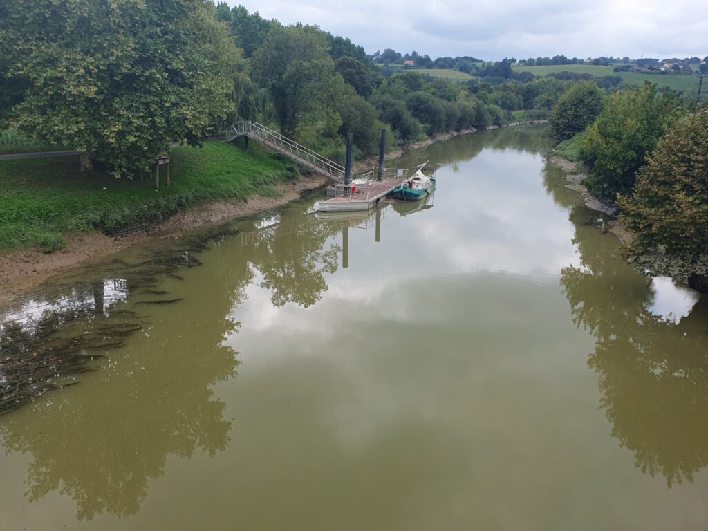
Continuing along the Adour, the next point of interest is the village of Port-de-Lanne.

The River Adour from just north of Port-de-Lanne to Dax
Bridge over the River Adour at Saubusse © Ricky Yates

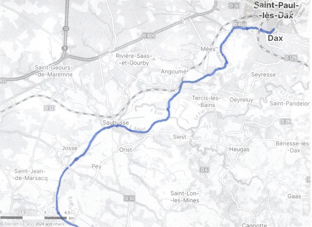
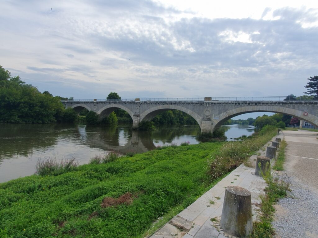
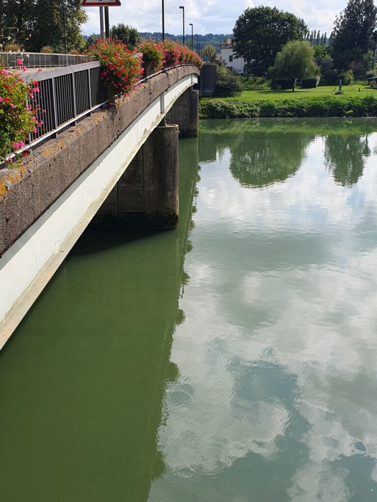
After one further bridge at Josse, the Adour reaches Saubusse where it is crossed by this historic bridge on which only one-way traffic is allowed and with a serious weight limit.

Road sign in Saubusse © Ricky Yates

This road sign is a reminder that commercial traffic once used to load and unload here in Saubusse.

In dry summers, Saubusse can sometimes be the limit of navigation. But when water levels are normal, the Adour should be navigable for a further sixteen kilometres to the town of Dax. When I was there in early September, the water level seemed fine though I didn’t see a boat moving on the river above Saubusse.

I would love to be able to cruise the River Adour and its connected waterways. But to do so, one would either need to bring a trail-able craft and launch it at a slipway. Or enter from the Bay of Biscay in a seagoing craft. Unfortunately, I don’t have access to either 🙁 There are no hire-craft, unlike on the rest of the French canal and river network. Maybe a business opportunity that someone is missing 😉

The Ludwig-Donau-Main-Kanal (LDM)

LDM Canal sign at Kelheim © Ricky Yates

Not only in recent months has there been a relative absence of blog posts here, even when I have managed to put fingers to keyboard, I’ve only usually written about my house, my long argument with Barclays Bank, or my ongoing ministry at the Dresden Frauenkirche. In times past, I’ve often written about my travels, both within and beyond the Czech Republic. This post is my first attempt to return to doing so.

On the weekend of 13th-14th April, I spent two nights in Regensburg, breaking my long drive from Stará Oleška to Beatenberg, Switzerland, where I attended the ICS Chaplains Conference – Monday 15th – Friday 19th April. On that weekend, my love of canals and inland waterways which I have previously written about here and here, led me to explore what remains of the Ludwig-Donau-Main-Kanal (LDM), deep in the Bavarian countryside.

The LDM was constructed between 1836 – 1846, from Kelheim on the Donau/Danube, about twenty kilometres west of Regensburg, to Bamburg on the River Main, a major tributary of the Rhein/Rhine. It thus crossed the European drainage divide as the Main/Rhein/Rhine flow to the North Sea whilst the Donau/Danube flows to the Black Sea.

Unfortunately, it was never a great economic success for three reasons. Firstly, its locks, of which there were exactly one hundred, had fairly small dimensions meaning that the much larger vessels that traded on the Main and the Donau/Danube, couldn’t pass through it. Goods had to be transhipped onto smaller vessels and it became a bottleneck.

Secondly, there were frequent problems with water supplies to the summit level which delayed through passage.

Thirdly, soon after it was opened, competing railways were built which could move goods more quickly and in greater quantities. The canal consequently lost trade in a similar manner to the narrow canals in the English Midlands.

The LDM Canal suffered considerable damage during the Second World War, especially where it passed through Nürnberg. Post 1945, it was therefore decided not to try and repair the bomb damage and the canal was officially abandoned in 1950.

Canal Harbour at Kelheim © Ricky Yates

The LDM Canal commences in Kelheim where it leaves the Donau/Danube. The first lock up from the river is followed by this large canal harbour. Alongside the harbour are signs explaining the history of the LDM. These were erected 2021 as part of celebrating the 175th anniversary of the canal being opened.

Canal Harbour near Beilngries © Ricky Yates

The next traces of the LDM I found were near the small town of Beilngries, forty kilometres north-west of Kelheim. Here there are the remains of another canal harbour, complete with a crane, but the canal bed is dry.

Mooring ring © Ricky Yates

But a mooring ring is still embedded in the harbour wall.

Aqueduct at Gösselthal © Ricky Yates

At Gösselthal, I discovered this quite substantial aqueduct. But as at Beilngries, the canal bed is dry.

LDM Canal in water, near Berching © Ricky Yates

However, from about a kilometre north of the aqueduct, the canal is in water. Sadly, it is blocked in numerous places where road bridges have been dropped, such as immediately behind where I was standing to take this photograph.

Lock 26 at Berching © Ricky Yates

This is Lock 26, located just north of Berching which, as you can see, is in good condition.

Canal Harbour at Neumarkt in der Oberpfalz © Ricky Yates

Whilst further north, in the larger town of Neumarkt in der Oberpfalz, there is another Kanalhafen/Canal harbour.

Stop gates on the LMD Canal near Oberölsbach © Ricky Yates

My last discovery, before returning to Regensburg on the Autobahn, was near the village of Oberölsbach. These are what I believe to be a set of stop gates, allowing a section of canal to be drained.

According to my map, the LDM Canal is in water, all the way from here to the outskirts of Nürnberg. Unfortunately, I didn’t have time to explore any further on this occasion 🙁 Within Nürnberg, post-1945 development has eliminated the line of the canal, whilst north of the city, the construction of Autobahn 73 has completely flattened it. But I believe there are some traces near to Bamburg, including Lock 100, which connects the canal to the River Regnitz which then flows into the River Main. One day visiting Bamburg is on my ‘bucket list’ 🙂

From 1960 to 1992, the Rhein-Main-Donau Canal (RMD) was constructed between Kelheim and Bamburg. Between Kelheim and Dietfurt, a few kilometres before Beilngries, the River Altmühl has been canalised by the building of three locks.

Kelheim Lock on the RMD Canal © Ricky Yates

Here is the first lock, just outside Kelheim. As you can see, the RMD Canal has been built with large locks that vessels that ply both the Donau/Danube and the Main can pass through. The LDM also canalised the same section of the Altmühl, but with thirteen locks.

Small pleasure craft leaving the lock at Kelheim © Ricky Yates

However, alongside the new large lock at Kelheim, there is also a much smaller one for pleasure boats to pass. I was lucky to see this little boat pass through.

After Dietfurt, the RMD Canal takes a more westerly route to Nürnberg and on to Bamburg, than the LMD Canal. And in place of the one hundred locks on the LMD, there are only sixteen on the RMD.