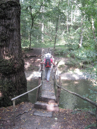
Last Wednesday, 21st December, I took my ‘day off’ for the week and went for a 12km circular walk through another part of Ceský Ráj. You can see and read about my two previous visits here and here. The day was dry and cold, -3°C according to the ‘Carly’, but unfortunately the afternoon sunshine promised by the BBC online weather forecast, didn’t materialise 🙁
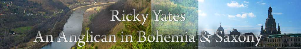
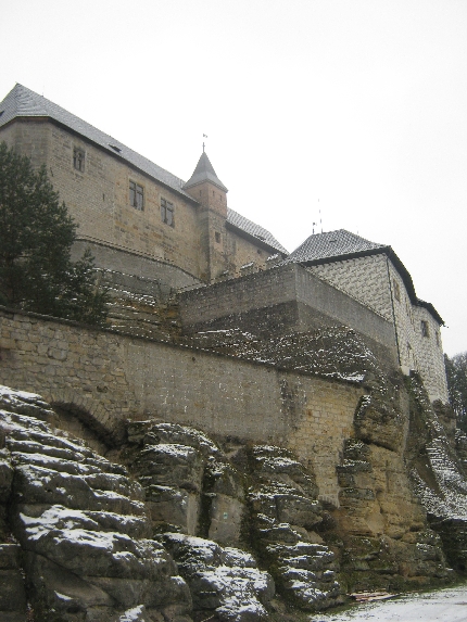
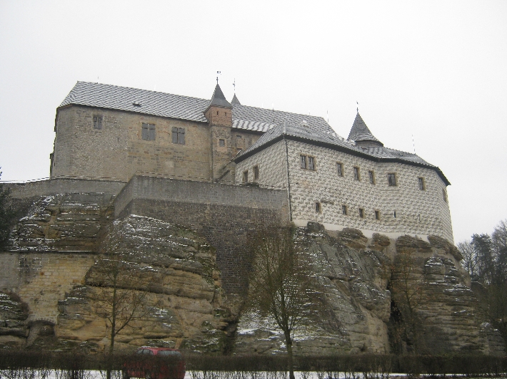
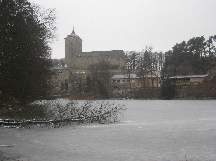
I started my walk at Hrad Kost / Kost Castle, built on one of the rocky outcrops which are such a feature of Ceský Ráj. The castle is open to the public between April – October, but not during the winter months. Therefore I was able to park the ‘Carly’ in the castle car park without paying a 50Kc fee 🙂
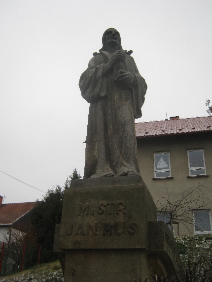
After walking for 3km along the red waymarked route, I arrived in Libošovice where, despite being a relatively small village, there is this sizeable statue of Jan Hus.
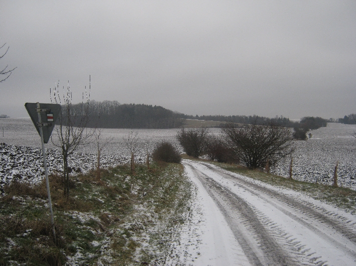
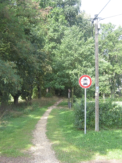
Then my walk took me across more open country along a snow-covered gravel track. Seeing this view did get me singing, ‘In the bleak mid-winter’ 🙂 Note the red waymark on the back of the road sign.
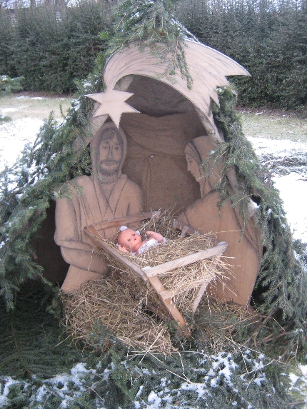
My return journey along the green waymarked route, took me through the small village of Rytírova Lhota where there was this delightful nativity display.
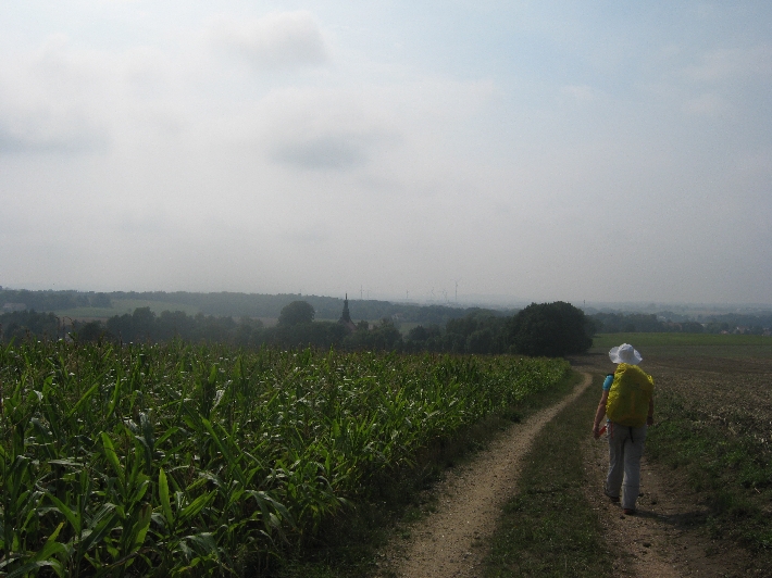
On the morning of Friday 21st August 2015, Sybille and I set out from the Pilgerherberge at Gröditz, to walk 20km to the large town of Bautzen. As you can see from the photographs, we were blessed with fine sunny weather.
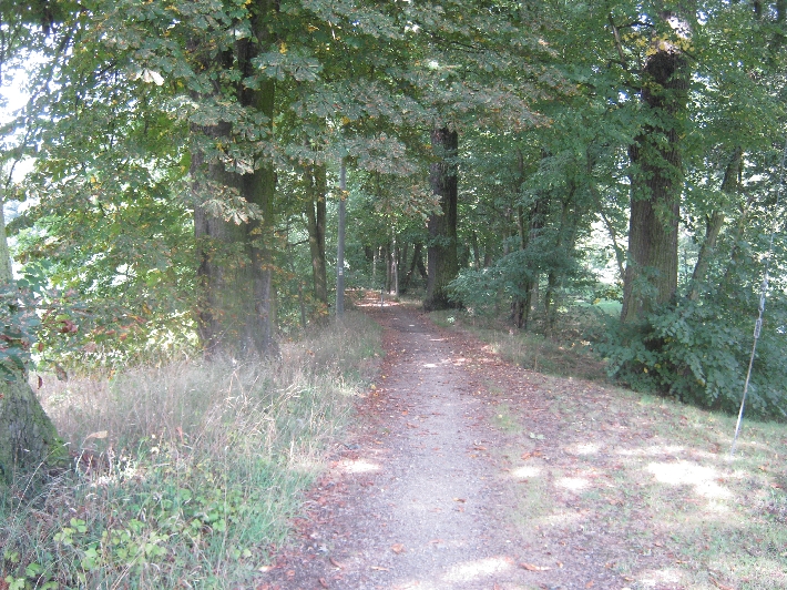
Our route took us along a series of tracks and minor roads across undulating countryside.
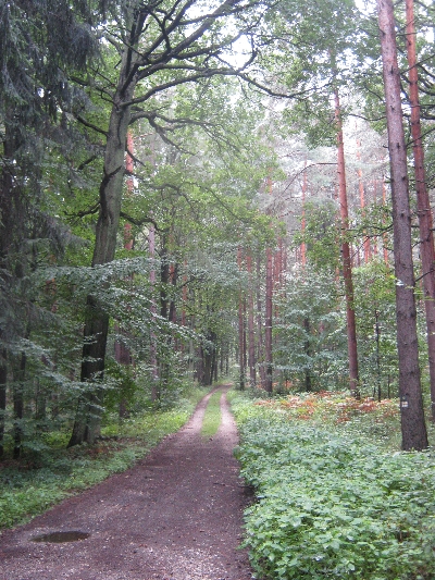
In view of the sunny weather, we both appreciated the shade provided by trees along parts of the route.
As on many pilgrim routes that I’ve walked, the approach to larger towns and cities is often not that pleasant for walkers. The last few kilometres into Bautzen involved walking uphill, alongside a busy main road. But we eventually made it, obtained the key to the pilgrim accommodation provided by the Lutheran Church, where we were able to shower, change and leave most of our belongings securely.
Nearby is St. Peter’s Cathedral, an example of a simultaneum or Simultankirche. Here Lutherans and Roman Catholics have shared the same Church building since 1530! After exploring more of the historic town centre, Sybille took me a very nice Sorbian restaurant which she had discovered during her pilgrimage earlier in April.
Fortunately, the route out of Bautzen the following morning, was along a series of quite quiet roads, though we did have to pass under the busy Autobahn 4. After 8.5km of walking, we reached the top of Roter Berg, a low hill on which has been erected the Milleniumsdenkmal featuring St Cyril and St Methodius, Apostles to the Slavs. Methodius was made a bishop therefore he is the one wearing a mitre 🙂
That afternoon, we walked on a further 8.5km, to the town of Crostwitz. Just outside the town, the correct way was indicated by a yellow arrow, painted on the road!
In Crostwitz, we stayed overnight in this Pilgerherberge owned and run by a lady called Monika. She is a native speaker of Sorbian, the West Slavic language I mentioned in my previous post. In Crostwitz, the secondary/high school, teaches through the medium of Sorbian, with German only being taught as a second language.
Monika explained that when this area was part of the Soviet satellite state of East Germany, the communist authorities actively encouraged the use and preservation of the Sorbian language. This was because of it being a Slavic language and so much of what happened was orchestrated by the Russians in Moscow, their ‘fellow Slavs’ 😉 It is ironic that now, one place where the language continues in active use, is within the Church. On the evening of Saturday 22nd August 2015, Sybille and I went to a very well-attended mass in the Roman Catholic Parish Church, conducted only in Sorbian.
Believe it or not, despite only being spoken by about 50,000 people, there are two different versions of Sorbian! About 40,000 people speak Upper Sorbian and live in the Bundesland of Freistaat Sachsen, the area we were walking through. Immediately north, in the Bundesland of Brandenburg, there are a further 10,000 speakers of Lower Sorbian. Upper Sorbian relates more to Czech; Lower Sorbian to Polish.
Our final day on this first part of the ÖkumenischePilgerweg was Sunday 23rd August 2015, when we walked 16.5km from Crostwitz to Kamenz. Once more it was fine and sunny and my main recollection of that day, was finding nowhere that was open to serve us a cool drink! Fortunately, when we reached the eastern outskirts of Kamenz, we had to walk right through where a travelling fair was set up for a week and we finally were able to purchase a couple of beers.
We then walked on to the town centre to the tourist information centre, where we collected the key to the Pilgerherberge. Following that, we treated ourselves to a further beer, sitting outside a hotel on the town square, opposite the Rathaus. One problem we encountered throughout our week on the ÖkumenischePilgerweg, were an abundance of wasps, who tended to take a great interest in any beer we were drinking. This was a novel way of preventing them doing so 🙂
My other recollection of the whole week was the almost total absence of anyone who spoke English. My normal experience of trying to use my limited German when in Germany, is being spoken back to in word-perfect English! But the first time this happened to me during our five days on the ÖkumenischePilgerweg, was in Kamenz, ordering this beer and a different one for Sybille, who had gone off to use the toilet facilities in the hotel. I presume the reason for the lack of English was being in the former East Germany and being places not normally frequented that much by non-German tourists.
As explained in the opening two paragraphs of my previous post, back on Tuesday 18th August 2015, Sybille and I drove from Prague to Görlitz, in order to spend the following week walking the first part of Der Ökumenische Pilgerweg. We stayed overnight in the Peregrinus Herberge, where we were also able to leave the ‘Carly’ securely parked, before setting out along the Pilgerweg the next morning.
With Görlitz being located in the valley of the Neiße river, it was inevitable that initially walking westwards to leave the town, involved walking uphill! However, we were soon out into open countryside and having covered 5km……
From Ebersbach, there was then a gentle further climb along a minor road to the small village of Liebstein. The way then heads into a large and hilly forested area, following a series of gravelled tracks. 15km after leaving Görlitz, we finally arrived at Hochstein, at 406m above sea level, the highest point on the Pilgerweg east of Leipzig. Fortunately, it is also the location of the Hochsteinbaude where we were able to enjoy a drink and a late lunch. We were glad that we hadn’t arrived the previous day as Dienstag ist Ruhetag!
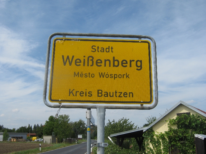
sometimes following minor roads, until we reached the small town of Weissenberg. Weissenberg marks the beginning of this part of south-eastern Germany where Sorbian is spoken, which is a legally recognised minority language, hence the town’s alternative name Wóspork. Sorbian is a West Slavic language, closely related to Czech and Polish – more in my next blog post.
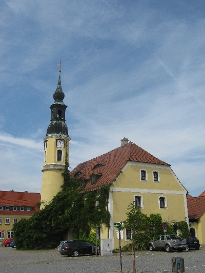
After lunch at an outdoor table of a restaurant situated on the main square, opposite the Weissenberg Rathaus, we walked on, heading for the village of Gröditz.
We eventually climbed out of the valley to arrive directly before the door of the Gröditz Pilgerherberge. For those interested in distances, Arnsdorf – Gröditz is about 15.5km.
The town of Görlitz is located in the far south-eastern corner of Germany and is about two-and-a-half hours drive directly north from Prague. Back on Tuesday 18th August 2015, Sybille and I drove to Görlitz, in order to spend the following week walking the first part of Der Ökumenische Pilgerweg. This is the first of three long-promised posts about that week mentioned in my summary post entitled ‘All those things in the second half of 2015 that got missed‘.
Having securely parked the ‘Carly’ in the gated backyard of the Peregrinus Herberge, we spent the rest of Tuesday 18th August, exploring Görlitz, before setting out walking along our pilgrimage route the following morning. On Monday 24th August, we returned to Görlitz by train, from Kamenz, which we had reached on foot the previous evening, and decided to further explore Görlitz, before driving back to Prague the next day. On Tuesday 18th it was grey and cloudy, whilst on Monday 24th it was fine and sunny with blue skies. Therefore it is fairly easy to tell on which day the photographs illustrating this post were taken 🙂
Görlitz fortunately suffered relatively little physical damage during the Second World War. Post 1945, whilst part of the communist state of East Germany, it was rather grey and colourless. Since German reunification, many buildings have been redecorated and restored. It is now a very attractive place to visit and is beginning to realise its tourist potential.
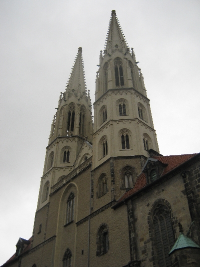
The most prominent landmark in Görlitz, is the Protestant Church dedicated to St Peter and St Paul, with its intricate twin spires. It stands overlooking the Neiße river which now forms the border between Germany and Poland. Under the 1945 Potsdam Agreement, following the end of the Second World War, the border of Poland was moved westwards to the Oder-Neiße line. As a result, what used to be the eastern half of German Görlitz, is now the Polish town of Zgorzelec.
We discovered a couple of interesting businesses in Görlitz. This shop sells everything imaginable in relation to Christmas but is open all year round.
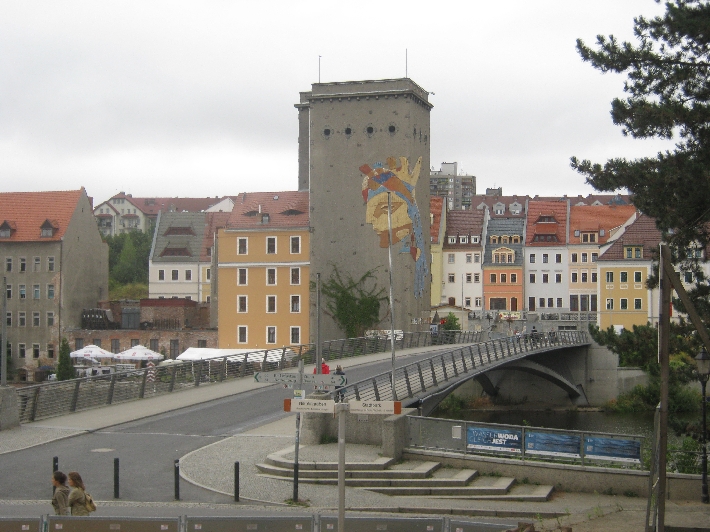
On sunny Monday 24th August, Sybille and I enjoyed some liquid refreshment on a terrace overlooking the bridge and the Neiße river. The young ladies serving us spoke German and we ordered auf Deutsch. But afterwards Sybille told me that they were Polish as she could tell by their accent 🙂
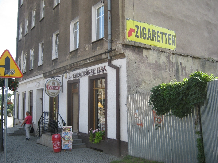
Suitably refreshed, we walked over the bridge into Poland. Clearly there is less tax on cigarettes in Poland than in Germany, hence the advertisement in German for cigarettes, on the side of a Polish shop 😉
We then walked south through part of Zgorzelec, parallel to the Neiße, before crossing another bridge to return to Germany, Freistaat Sachsen and Görlitz. With both Poland and Germany being EU members and part of the Schengen agreement, there were no border controls at all.
On Monday 15th February, I took a proper ‘day-off’ and went for a near 20km walk in Ceské Švýcarsko – Bohemian Switzerland, the beginning of keeping the promise I made at the end of my previous but one blog post. I saw enough during my day trip, to encourage me to return and further explore this attractive area.
I drove north-west from Prague, to the port town of Decín on the Labe River, and then a further 12km north alongside the Labe, (which becomes the Elbe on entering Germany), to the border settlement of Hrensko. Here I turned onto a minor road along the Kamenice river valley to the eastern end of the settlement, where there was a designated car park in which I duly parked the ‘Carly’. According to a sign, its costs CZK 30 per hour to park, or CZK 120 for the day. But being a Monday in February, there was no attendant waiting to collect my fee!
Hrensko basically consists of hotels and other forms of accommodation, together with several bar-restaurants, all aimed to meet the needs of the visiting walker and tourist. Unfortunately, because of its proximity to the German border, it also has a number of ‘night clubs’ which are little more than euphemisms for brothels. These are almost exclusively patronised by visiting German males, especially at weekends.
From where I parked the ‘Carly’, I first walked for over 1.5km along a minor tarmac road, following the waymarking for the red walking route, to a point where the red route leaves the road and climbs up into the hills. I was glad I hadn’t followed my original instinct and driven to this point and tried to park, because there was a large sign saying that doing so, would result in a CZK 5000/£145.00 fine. It was either park back where I was parked, or alternatively a further 3km further on.
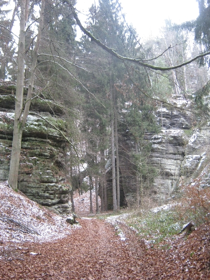
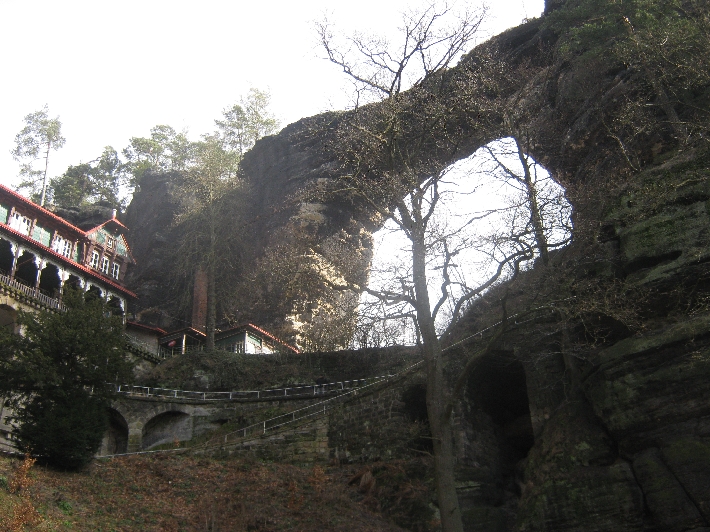
Climbing the red route took me to the most famous feature of Ceské Švýcarsko – Bohemian Switzerland – Pravcická brána. It has a span of 26.5 metres, an inside height of 16 metres, 8 metre maximum width and 3 metre arch and is the largest natural sandstone arch in Europe.
In the latter half of the nineteenth century, a hotel and restaurant was built alongside this amazing natural feature, as you can see on the left of my photograph. These days, it functions as a National Park information centre and restaurant. Between November and March, it is only open at weekends meaning I couldn’t reward myself with a cool beer after my steep climb. Quite how supplies are delivered to the place I have no idea as there is no access road – just the footpath.
I met or passed a small number of other walkers on this route, all of whom were Germans! My ‘Dobrý den’ was greeted with blank looks, whilst ‘Guten Tag’ gained a positive response 🙂
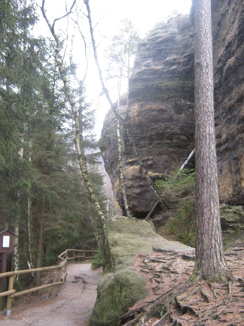
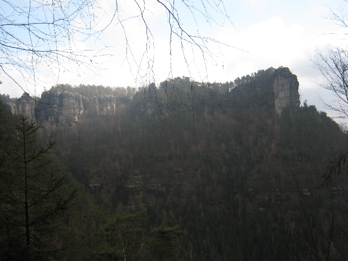
Having descended 500m from Pravcická brána, I continued eastwards along the red route for a further 6.5km. This first gave me a rear view of the sandstone arch.
…….and a series of amazing views. Unfortunately, at this point, my camera batteries decided to die so I have no further photographs.
The route itself was occasionally undulating but mainly level, until the last couple of kilometres when it descended to the small village of Mezní Louka. Walking this route I only met one other couple, coming in the opposite direction. Otherwise, I had the whole of the wilderness to myself.
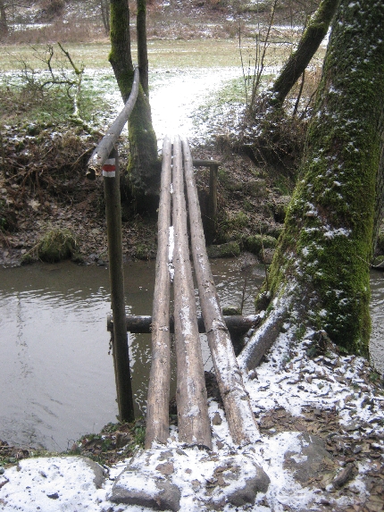
I made my return journey to the ‘Carly’, first walking a green waymarked route along a minor road to the village of Mezná. Then it was the yellow waymarked route along a gravelled forestry track, finally followed in the reverse direction, by the same 1.5km minor road that I’d set out along several hours earlier.