Four years ago……

Decín Zámek/Château © Ricky Yates

….Sunday 27th March 2016 was Easter Day. The following day, I put myself on a train from Prague to Decín, intending to spend my post-Easter break, walking for a few days in Ceské Švýcarsko – Bohemian Switzerland, fulfilling the promise I made to myself when I had paid a day visit to the area, some six weeks previously.

Surprisingly at the time, I never wrote about this visit here on my blog. But a combination of the fourth anniversary, together with the need to occupy my evenings whilst currently in lock down because of the corona virus, means I’m doing so now. And whilst I have previously explained here, why I chose to retire and live in North Bohemia, I still regularly am asked why I chose this particular part of North Bohemia in which I now live. This post may help to answer that question.

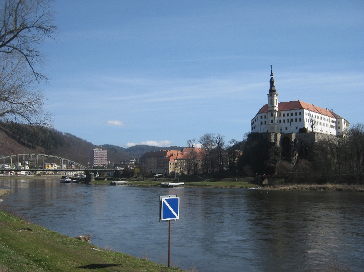
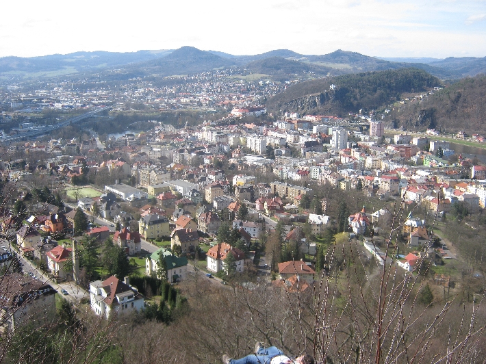
Around midday on that Easter Monday 2016, I set off from Decín station, first alongside and then over the Labe river, through the town centre, in order to join the red waymarked route and walk to the border village of Hrensko.

Zigzag path © Ricky Yates

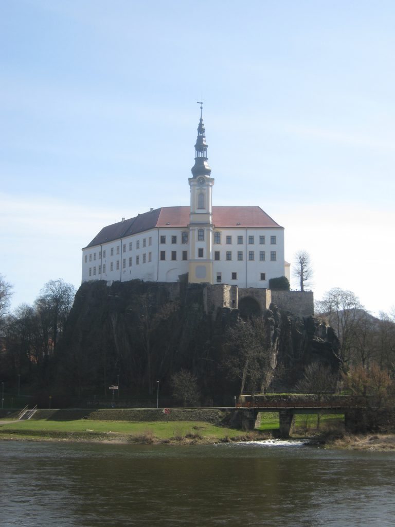
After a steep climb up this zig-zag path, I was rewarded with a splendid view of Decín.

Kanon Labe © Ricky Yates

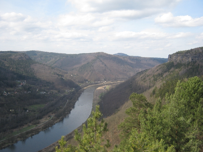
Further on, there were wonderful views of Kanon Labe which I have described and illustrated in this more recent post.

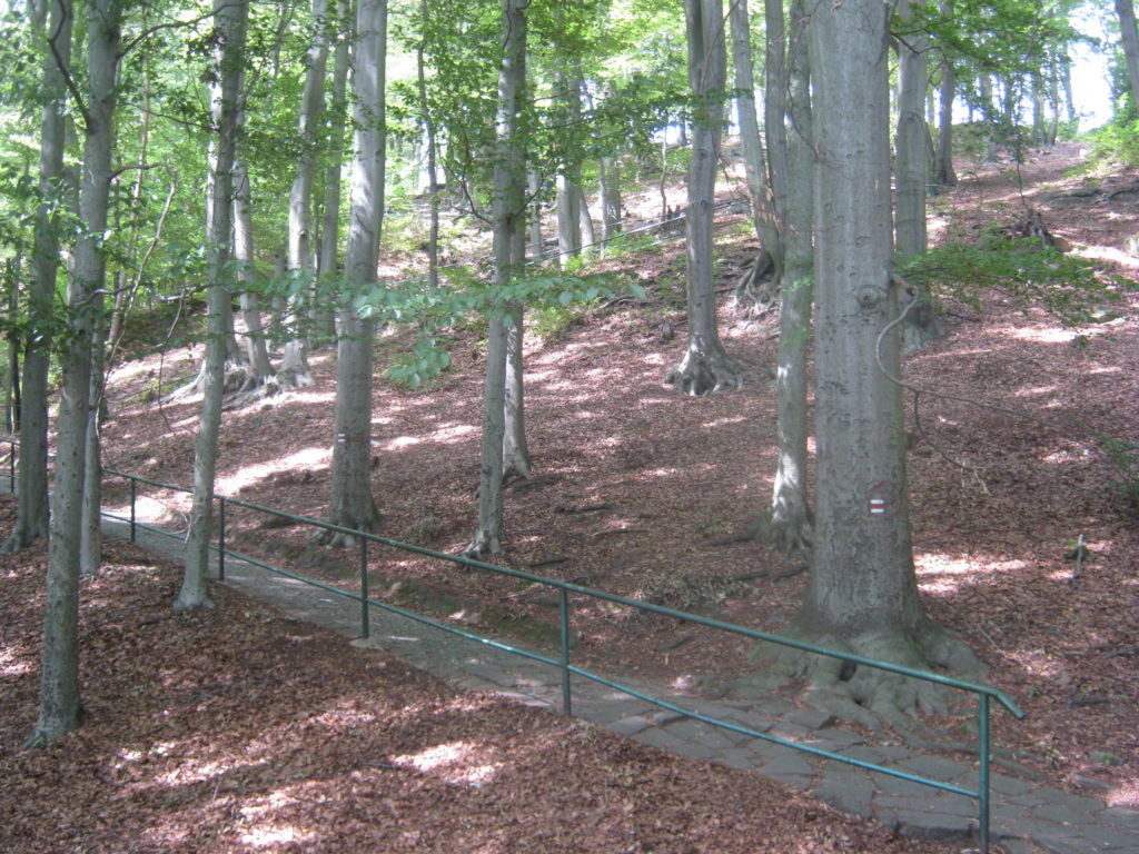
The path then took me for several kilometres through the forest to the village of Labská Strán.

Sign on outskirts of Labská Strán © Ricky Yates

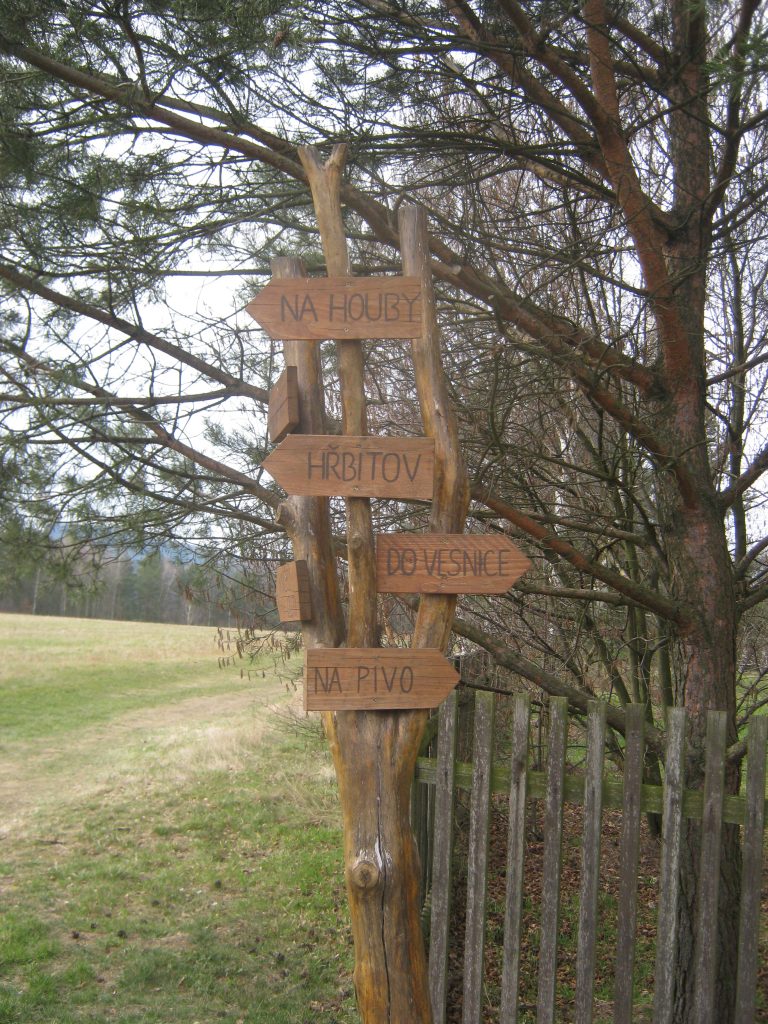
On the outskirts of the village was this delightful sign. To the left you will find the Hrbitov/Cemetery, whilst to the right is the way do vesnice/to the village. But the top fingerpost tells you where to go Na houby/for mushrooms, whilst the bottom fingerpost tells you where to go Na pivo/for a beer 🙂 Only in the Czech Republic!

From Labská Strán, the path descended into, and then along, an almost dry river valley before becoming a narrow pavement alongside the main Decín – Dresden road and the Labe river, for the last 1.5km into Hrensko. Having walked over 20km, I was very pleased to reach Hotel Labe where I had already booked to spend the night.

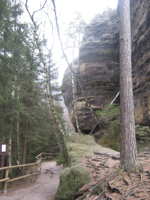
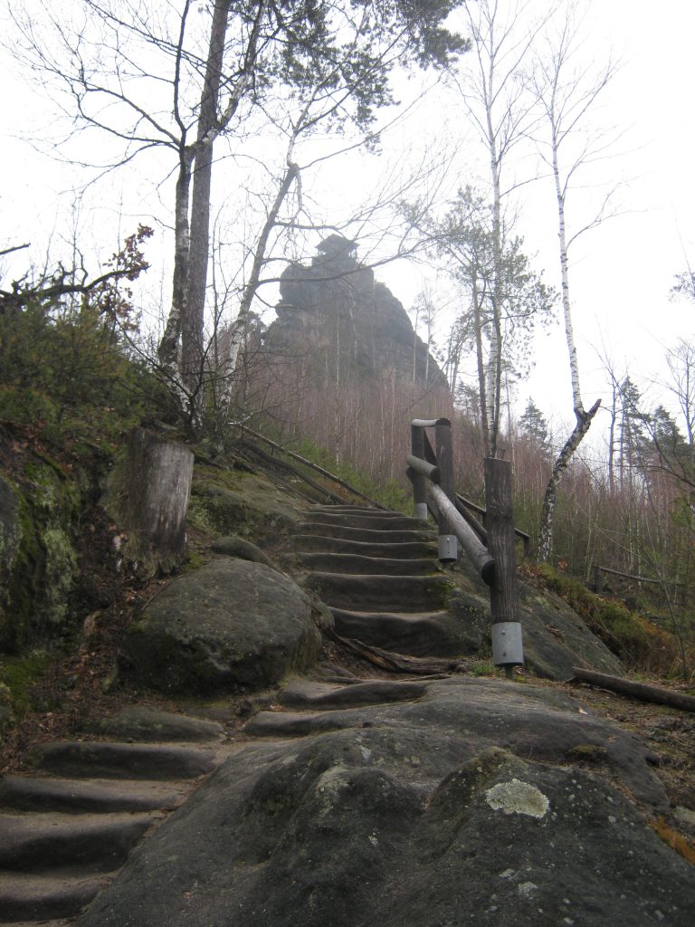
The next day, I continued along the red waymarked route, repeating the first part of the walk I had undertaken on my day visit, six weeks earlier. This took me up to Pravcická brána…..

Pravcická brána © Ricky Yates

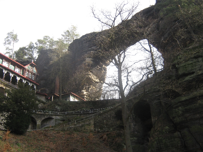
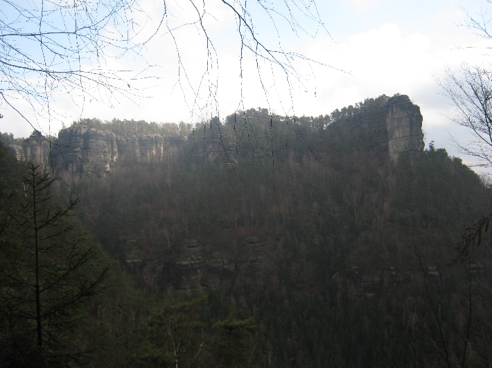
…..and then along under steep cliffs…..

Steep cliffs © Ricky Yates

…….to the small village of Mezní Louka. But it was whilst I was on this section of my walk that I had an unfortunate mishap. My old but faithful trekking pole snapped and would no longer support me.

Whilst walking the Chemin de St Jacques, in France, in 2002, I became a convert to walking with a trekking pole. Particularly as I have got older, I don’t feel confident walking on an uneven path, without a trekking pole in hand, to help me keep my balance. This is especially true if I’m also carrying several kilos in a backpack. Therefore I was quite pleased to reach the road at Mezní Louka, without falling over!

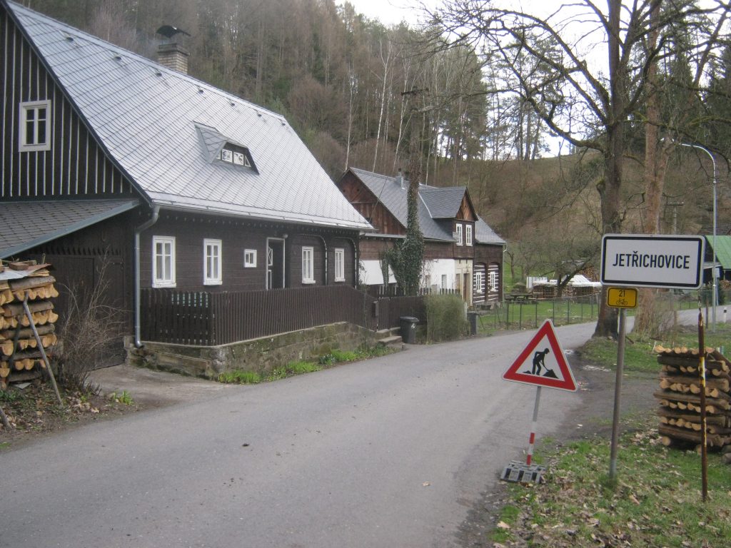
I had planned to continue walking along the red waymarked route, to the village of Jetrichovice, where I had already booked ahead to spend the night in Penzion Drevák. But without a functioning trekking pole, I decided that discretion was the better part of valour. Instead, I took a different route, partly consisting of gravelled tracks and the rest along tarmacked roads. Thus I safely walked into Jetrichovice, later that afternoon.

Jetrichovice © Ricky Yates
Penzion Drevák © Ricky Yates

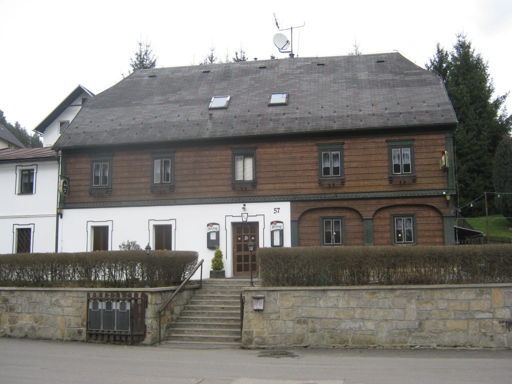
After checking in at Penzion Drevák, I went for a short walk around the village. Within sight of the penzion was a bus stop, on which there was the timetable of bus service 436, into Decín. Believing that a town of 50,000 people, next to a popular walking area, would have a sports shop selling trekking poles, I noted the time of a bus departing mid-morning the next day, and told my hosts at the penzion, I would be staying with them a second night.

The next morning after breakfast, I went to the bus stop in good time and waited. Very close to the designated time, along came the bus. There followed a very scenic bus journey lasting nearly an hour, through a whole series of attractive villages, including one called Stará Oleška 🙂 Yes, that bus journey actually took me past the front door of the house where I now live!

Upon arrival in Decín, I searched the town centre, looking for a sports shop, but couldn’t find one. Eventually I spotted new shopping complex slightly out of the town centre, with a large Kaufland supermarket – the place where I now do nearly all my food shopping. Next to it was, and still is, a large Sportisimo sports shop. Inside, I found a pair of trekking poles for a very reasonable price. Mission accomplished!

After a pub lunch, I caught the early afternoon bus and enjoyed the same scenic journey of a few hours earlier, in the reverse direction, back to Jetrichovice.

Mariina skála © Ricky Yates

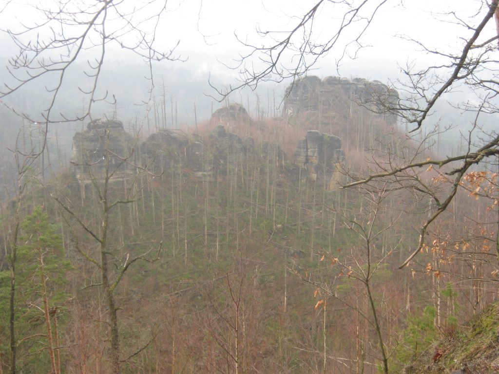
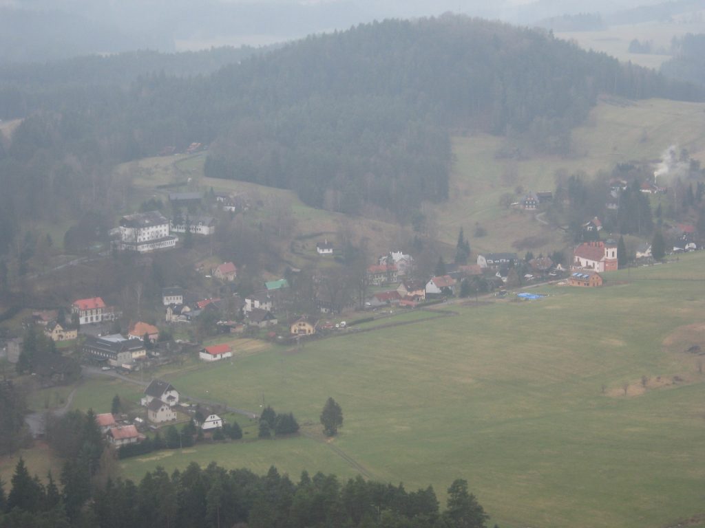
The next day, I did walk part of the red waymarked route I had avoided two days earlier. I climbed from Jetrichovice, up to Mariina skála, from where there are wonderful views over the surrounding area. Very worthwhile, even though it was a bit misty that day.

View from Mariina skála © Ricky Yates
Jetrichovice as seen from Mariina skála © Ricky Yates

Slightly further on is Balzerovo ležení, an interesting rock formation which has a picnic table beneath it. Please note my shiny new trekking pole propped up against the table 🙂 Then, rather than retracing my steps, I made a circular return to Jetrichovice, via the yellow waymarked route.

Balzerovo ležení with picnic table © Ricky Yates

On Friday 1st April 2016, I once more caught the 436 bus in Jetrichovice, all the way to Decín railway station for my return journey to Prague. Exploring this specific area on foot and then by bus, left a permanent impression on me. Whilst I never said to myself that I wanted to live in a village on the 436 bus route, when nearly a year later, I saw the house in which I now live, on the Vesta Reality website, I knew immediately where is was. And the rest, as they say, is history!

A walk above Kanon Labe

The Labe river flowing towards Germany, where it becomes the Elbe © Ricky Yates

On Saturday 1st September, a group from my former congregation at St Clement’s Anglican Episcopal Church, Prague, are travelling by train to Decín, for me to take them on a guided walk through the Labské pískovce Protected Landscape Area where I now live. This post is both an account of my research for that walk and is also aimed at giving the prospective participants, a taster of what they can look forward to experiencing 🙂

The walk starts in the village of Ludvíkovice, which lies between Decín and Stará Oleška. From outside the Post Office, where I parked my car, I then walked into the forest a short way, to join the red waymarked route that comes up from Decín and is part of the E3 European long distance path. Heading north and climbing steadily for about 1.5km, the path arrives at the first spectacular viewpoint, Vyhlídkové místo.

This is the view looking north with the Labe river flowing towards Germany, where it becomes the Elbe.

The view looking south, back towards Decín © Ricky Yates

Whilst this is the view looking south, back towards Decín.

View from Vyhlídkové místo © Ricky Yates

Slightly further on, there is second viewpoint, also called Vyhlídkové místo 😉 , from where the full extent of the forest lying below the cliffs and stretching down to the valley floor, can be seen.

From Vyhlídkové místo, there is a shallow valley to be crossed, followed by a short climb up a zigzag path to Ružová vyhlídka, at 433m above sea level, the highest point on the route.

The view south from Ružová vyhlídka © Ricky Yates

This is the view south from Ružová vyhlídka. Decín in the far distance, stands at 135m above sea level which means that Kanon Labe is nearly 300 metres deep.

The view north from Ružová vyhlídka © Ricky Yates

And the view north.

The green waymarked route through the forest © Ricky Yates

From Ružová vyhlídka, the red waymarked route is followed for a further kilometre before turning off onto the green waymarked route, heading back south through the forest.

Slunecná brána © Ricky Yates

The path then passes this fascinating geological feature, Slunecná brána, a small sandstone rock arch formation. As you can see, there is a seat provided if you need to rest your weary legs 🙂

The village of Ludvíkovice © Ricky Yates

The path then undulates through the forest, with glimpses of the village of Ludvíkovice through the trees, completing a circular walk and rejoining the red waymarked route.

Retracing my earlier steps for about 0.5km, rather than then walk back into Ludvíkovice, I continued along the red waymarked route, in the direction of Decín. This leads to two further viewpoints.

Sandstone pavilion at Vyhlídka Labská stráž © Ricky Yates

The first of these is Vyhlídka Labská stráž where there is this sandstone pavilion, originally built in the late nineteenth century. As you can probably see in the photograph, the safety barriers have been recently repaired. The stonework has also been re-pointed, restoring the building to its former glory.

The view from Vyhlídka Labská stráž © Ricky Yates

From the pavilion there is this splendid view. On the west/left bank of the Labe is the Prague-Decín-Dresden railway, whilst on the east/right bank, is the main road from Decín to Dresden.

Decín, as viewed from Císarský výhled © Ricky Yates

A further kilometre on from Vyhlídka Labská stráž, is Císarský výhled, which provides expansive views across Decín.

Zigzag path © Ricky Yates

From Císarský výhled, the red waymarked route then descends down this zigzag path to a bus stop opposite Decín hospital. There is a local bus from here, directly to the main railway station. On the day of my exploration, I had to walk to another stop to get a bus back to my parked car.

Decín

Decín on the Labe river with the Zámek/Château on the right © Ricky Yates

Decín is a town that lies either side of the Labe (Czech), Elbe (German), river. It is situated at the beginning of a deep gorge where the Labe cuts through the Elbe Sandstone Mountains, Labské pískovce (Czech), Elbsandsteingebirge (German), on its way to Dresden in Germany and eventually flowing into the North Sea beyond Hamburg. The area to the east of the Labe is known as Bohemian Switzerland, Ceské Švýcarsko (Czech), Böhmische Schweiz (German), about which I’ve written previously here on my blog.

Decín is 130km north-west of Prague and takes around one-and-a-half hours to reach by either road or rail. But its closeness to the German border means that it only takes forty-five minutes by train to get to Dresden. Therefore it is in the vicinity of Decín that I am hoping to buy my retirement home and continue with my English-language ministry at the Frauenkirche in Dresden.

A major feature of the town is a splendid Zámek or Château, overlooking the river. During the Communist era, it was occupied by military forces of the Soviet Union. Since their departure in 1991, it has been restored to its former glory and in 2005, it was opened as a museum and venue for private gatherings and public events.

Decín from the north-east © Ricky Yates

The historic centre of Decín, Tetschen (German), is on the east bank of the Labe, with a separate newer settlement on the west bank called Podmokly. But the two were amalgamated by the Nazi regime in 1942 and are now linked by two road and two railway bridges. Today, the population of the town is about 50,000 and it has all the facilities I might need, including major supermarkets and a hospital. I shall certainly use the former – hopefully not the latter!

Wharf © Ricky Yates

The Labe is navigable all the way to Hamburg as well as in the other direction, as far as Pardubice in the Czech Republic. This photograph shows one of the wharfs where freight can be unloaded from barges and transferred directly to trucks on the neighbouring railway.

The Labe gorge north of Decín © Ricky Yates

The gorge north of Decín is spectacular. The Prague-Decín-Dresden railway line runs along the west (left) bank of the Labe lying within the line of trees above the minor track visible in this photograph. The main road is on the east (right) bank of the river, immediately below the cliffs.

Decín main railway station © Ricky Yates

The closeness of Decín to the German border is well illustrated by this sign on Decín hl.n./ Decín main railway station, which informs passengers that they are on platform one, in both Czech and German 🙂

My apologies that once again I’ve had problems with Czech diacritics. There should be a hácek (little hook) above both the ‘e’ and ‘c’ in ‘Decín as there should be above the ‘c’ in ‘hácek‘. But unfortunately, if I insert them in my text, the town becomes D??ín 🙁


A walk in Ceské Švýcarsko – Bohemian Switzerland

The path to Pravcická brána © Ricky Yates

On Monday 15th February, I took a proper ‘day-off’ and went for a near 20km walk in Ceské Švýcarsko – Bohemian Switzerland, the beginning of keeping the promise I made at the end of my previous but one blog post. I saw enough during my day trip, to encourage me to return and further explore this attractive area.

I drove north-west from Prague, to the port town of Decín on the Labe River, and then a further 12km north alongside the Labe, (which becomes the Elbe on entering Germany), to the border settlement of Hrensko. Here I turned onto a minor road along the Kamenice river valley to the eastern end of the settlement, where there was a designated car park in which I duly parked the ‘Carly’. According to a sign, its costs CZK 30 per hour to park, or CZK 120 for the day. But being a Monday in February, there was no attendant waiting to collect my fee!

Hrensko basically consists of hotels and other forms of accommodation, together with several bar-restaurants, all aimed to meet the needs of the visiting walker and tourist. Unfortunately, because of its proximity to the German border, it also has a number of ‘night clubs’ which are little more than euphemisms for brothels. These are almost exclusively patronised by visiting German males, especially at weekends.

From where I parked the ‘Carly’, I first walked for over 1.5km along a minor tarmac road, following the waymarking for the red walking route, to a point where the red route leaves the road and climbs up into the hills. I was glad I hadn’t followed my original instinct and driven to this point and tried to park, because there was a large sign saying that doing so, would result in a CZK 5000/£145.00 fine. It was either park back where I was parked, or alternatively a further 3km further on.

Pravcická brána © Ricky Yates

Climbing the red route took me to the most famous feature of Ceské Švýcarsko – Bohemian Switzerland – Pravcická brána. It has a span of 26.5 metres, an inside height of 16 metres, 8 metre maximum width and 3 metre arch and is the largest natural sandstone arch in Europe.

In the latter half of the nineteenth century, a hotel and restaurant was built alongside this amazing natural feature, as you can see on the left of my photograph. These days, it functions as a National Park information centre and restaurant. Between November and March, it is only open at weekends meaning I couldn’t reward myself with a cool beer after my steep climb. Quite how supplies are delivered to the place I have no idea as there is no access road – just the footpath.

I met or passed a small number of other walkers on this route, all of whom were Germans! My ‘Dobrý den’ was greeted with blank looks, whilst ‘Guten Tag’ gained a positive response 🙂

Rear view of Pravcická brána © Ricky Yates

Having descended 500m from Pravcická brána, I continued eastwards along the red route for a further 6.5km. This first gave me a rear view of the sandstone arch.

The path alongside cliffs © Ricky Yates

It then took me past rock cliffs…..

A view across Ceské Švýcarsko © Ricky Yates

….and a series of amazing views. Unfortunately, at this point, my camera batteries decided to die so I have no further photographs.

The route itself was occasionally undulating but mainly level, until the last couple of kilometres when it descended to the small village of Mezní Louka. Walking this route I only met one other couple, coming in the opposite direction. Otherwise, I had the whole of the wilderness to myself.

I made my return journey to the ‘Carly’, first walking a green waymarked route along a minor road to the village of Mezná. Then it was the yellow waymarked route along a gravelled forestry track, finally followed in the reverse direction, by the same 1.5km minor road that I’d set out along several hours earlier.

Melník

The Church of St. Peter & St. Paul, Melník © Ricky Yates

Following my recent busy July weekend, I am now on annual leave until the end of the month. For a variety of reasons, we’ve decided to have a stay-at-home holiday or ‘staycation’ as I gather Americans call it. For these next two weeks, we’ve written out a list of places in or around Prague that we either want to visit for the first time, or re-visit because we missed something previously, or because we want to go in summer having previously visited in another season.

On Tuesday 17th July, we visited Melník, a small town which lies around 35 km directly north of Prague at the confluence of the Vltava and Labe/Elbe rivers. Melník comes into the third category outlined in the previous paragraph as we had been there once previously at the beginning of January 2009. On that occasion, there was snow lying on the ground and the two main attractions were both closed! It was also a few weeks before I commenced writing this blog and some months before I bought my current camera, thus meaning I have no written or photographic record of that trip.

The historic centre of Melník is situated on the top of a hill overlooking the confluence of the two rivers with a steep drop down to the water’s edge. Right on top of the hill stand the two most significant buildings in the town – the Church of St. Peter and St. Paul with its tall tower, and ‘Zámek Melník‘, a Renaissance château belonging to the Lobkowicz family.

Cobbled street in the centre of Melník with Restaurace U Rytiru on the right © Ricky Yates

We drove to Melník and upon arrival, found a suitable parking spot for the car, and then walked into the centre of the town. We headed for the Church and Zámek, and just before reaching them, decided to have a late lunch at Restaurace U Rytiru, sitting under one of the red Budweiser umbrellas on the right in the photograph above.

Cross made from human skulls & bones in the crypt of the Church of St. Peter & St. Paul, Melník © Sybille Yates


Then it was off to see the somewhat macabre feature of the Church – the old crypt which is an ossuary containing the bones of more than 10,000 people, dug up to make room to bury plague victims in the sixteenth century. When the crypt, which had been previously walled up, was re-opened in the late nineteenth century during renovation work on the Church, a professor at Charles University in Prague undertook anthropological studies on the bones and arranged them into some interesting patterns including this cross.


The Labe/Elbe River at Melník with the navigation channel and lock that circumvent the first section of the Vltava River © Ricky Yates

Walking between the Church and Zámek Melník, we reached a spot from where there is a wonderful view across the Central Bohemian countryside and, in the foreground, the confluence of the Vltava and Labe/Elbe rivers. A navigation channel and lock, built in the first decade of the twentieth century, allows boats to circumvent the first few unnavigable kilometres of the Vltava. The metal plaque shown below, explains which waterway is which!

Plaque explaining which waterway is which! © Ricky Yates

We then headed for Zámek Melník, not least because of the onset of a very heavy thundery downpour! This photograph, taken in the courtyard of the Zámek, shows some of the sgraffito decoration on the exterior walls of the building.

Zámek Melník with exterior sgraffito decoration © Ricky Yates

There was also this sundial on one of the courtyard walls which was unfortunately rather redundant in view of the weather 😉

The sundial on the exterior of Zámek Melník © Ricky Yates

We took a most enjoyable tour of the interior of the Zámek but, as is sadly now commonplace in many historic houses, no photography was allowed. However, we did appreciate being able to walk through the various rooms at our own pace, without an accompanying guide. As might be expected, there was a variety of antique furniture and historic paintings to observe. We particularly liked the intricate decoration of many of the ceilings.

Church tower and vines at Melník © Ricky Yates


Before the heavens opened once again, I did manage to get this photograph which shows the Church tower, together with the vines that grow on the steep slope below the Church and Zámek Melník. Most Czech wine is produced in Moravia but some excellent, mainly white wines, are also produced in Bohemia, particularly in and around Melník.

The vineyard below the Church and Zámek Melník can also be clearly seen in the photograph below which I took, soon after we set out on our journey back to Prague by a different route to the one by which we came.


Zámek Melník and the Church tower with vineyards below © Ricky Yates

PS Before anybody points it out, I do know that there should be a hácek above the ‘e’ in ‘Melník’, just as there should be one above the ‘c’ in ‘hácek’. But as I have previously explained, for technical reasons beyond my comprehension, if I put one in, it will appear as ‘M?lník’ and ‘há?ek’.