Slapy Lake – Vodni Nadrž Slapy

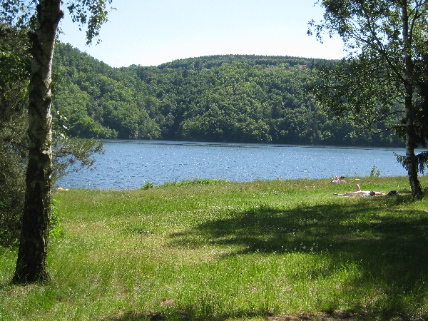
Slapy Lake © Ricky Yates

Last Monday, being my day-off, Sybille and I decided to take advantage of the warm sunny weather and pay our first visit this year to Vodni Nadrž Slapy – Slapy Lake, and the little lakeside village of Ždán. The village and lake are about 50km south of our home with the journey taking about an hour in the car, because of needing to either get through or around Prague, before being able to head out into the Bohemian countryside.
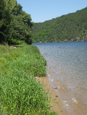
The lakeside beach at Ždán © Ricky Yates

Slapy Lake has been formed by the building of the Slapy Dam across the Vltava River. Both take their name from the village of Slapy which lies a couple of kilometers west of the site of the dam. As I explained in my earlier post entitled ‘A Trip up the Vltava River’, the dam was constructed during the Communist era between 1949 – 1955 in order to generate hydro-electricity, as well as to control river flow and hopefully help prevent flooding further downstream in times of high rainfall. Slapy Lake, behind the dam, stretches south for over forty kilometres and is widely used by small pleasure boats and yachts. Along the shore and in the surrounding wooded hills, there are a large number of Chata or Chalupa – little (usually wooden) holiday cottages. Outside of Scandinavia, the Czech Republic is probably the European country that has the highest percentage of population who own a country cottage/second home.

The village of Ždán consists mainly of holiday cottages of various shapes and sizes, together with a bar-restaurant, a couple of simple hotels and a slightly more upmarket yacht club. And between the lake shore and the narrow access road running through the village, there is a wide grassy area, partially shaded by a variety of trees, where you can freely walk, picnic, sunbathe and gain access the lake to go swimming.

I hope these accompanying photographs convey something of the beauty, simplicity and tranquility of this location and why we both like it so much. The water is clean and clear and was already pleasantly warm for swimming. And because we were there on a week day, it wasn’t at all busy, despite being a fine and sunny day with the temperature in the mid-twenties.

Sam the dog swimming in Slapy Lake © Ricky Yates

Another reason why I find this spot so relaxing is the almost total lack of signs or regulations, instead leaving people to use their commonsense. Since we were last here in 2010, some strategically placed boulders or a stretch of low fence mean you can now only pull onto the grass and park at one end of the area. But there is none of the ‘Health & Safety gone mad’ culture that you get in the UK these days with signs warning of the danger of drowning in water, or telling you not to do this or that.

Our day-out at Slapy Lake also cost very little beyond the petrol for the 100 km round trip in the car and 50 Kc for two pre-lunch beers. We packed a picnic lunch which we sat and ate in the partial shade of the surrounding trees.

This was also Sam the dog’s first real day out with us beyond his regular daily walks. Labradors are meant to be good swimmers so we did wonder how he would take to the water. After some initial uncertainty, he soon discovered that he could swim, particularly if we threw a stick into the lake for him to retrieve! I think both he and we look forward to several more return trips to Slapy Lake over the coming summer months.

Sam drying off under the trees © Ricky Yates

Flood defences and Communist artwork

New flood defence at Troja © Ricky Yates

On Mondays (my day off), and sometimes on Saturdays if I get the sermon finished in time, Sybille and I like to walk and explore different parts of Prague. Here are two pairs of pictures taken during two walking forays into different parts of the city during February 2011.

These first two pictures were taken in Troja, a suburb located on the other side of the Vltava from where we live and close to Prague Zoo. They show newly constructed flood defences, designed to protect the neighbouring housing and also the nearby zoo, from future flooding should the Vltava rise to levels similar to those experienced in the catastrophic floods of August 2002. These defences are quite new – when we were last here a few months earlier, major construction works were still underway.

The gap in the high concrete wall, allows road access to the riverside during times of normal river levels. But should water levels rise rapidly, then a sunken metal barrier can be raised between the two sections of the wall, blocking the road, but preventing floodwater from going any further.

New flood defence embankment and wall at Troja © Ricky Yates

The second picture shows the view alongside the river, at right angles to the first picture. The concrete wall with pillars on the left, is the continuation of the concrete wall in the first photograph. Again, there are sunken metal barriers between the pillars which can be raised in time of serious flooding. But when river levels are normal, the barriers are left down, allowing more light into the car park immediately behind the wall and the into the houses beyond.

Early Communist era artwork from 1951 © Ricky Yates

The second pair of photographs were taken in the suburb of Hanspaulka, a little further west from where we live. The housing in Hanspaulka mainly dates from the first four decades of the twentieth century. However, the suburb also contains a number of examples of blocks of flats built in the early years of the Communist era, to provide much needed additional housing for the growing population of post-war Czechoslovakia.

Much grandiose Communist era artwork on buildings in the Czech Republic has quietly been eliminated and destroyed. But this somewhat quaint piece above the doorway of a small-scale three or four storey block of flats, has survived. As it says, it dates from 1951, only three years after the Communist coup of 1948. It celebrates two archetypal labourers working in heavy industry, ironically located in a suburb where such heavy industry has never existed!

Location of Communist era artwork with twin bases for displaying flags © Ricky Yates

The second photograph puts the artwork in context, showing where it is located, above the entrance to the flats built to house the hardworking proletariat. It also shows another feature found on many buildings across Prague – the provision of metalwork, located immediately below the street number of the building, to allow the display of two flags. As I explained in an earlier post about public holidays in the Czech Republic, in the Communist era this was for the display of a flag of Czechoslovakia, alongside the flag of the country’s fraternal friend, the Soviet Union. These days, two Czech flags will be displayed!


Baba and Podbaba

'Residence Podbaba' with the Crown Plaza Hotel © Ricky Yates

The immediate area of Prague in which our home, the Chaplaincy Flat, is situated is known as Podbaba. The terminal station for the Number 8 Tram which we catch to travel into the City Centre to reach St. Clement’s Church, is also called ‘Podbaba’. ‘Pod’ in Czech means ‘under’ and behind our flats complex lies a steep wooded ridge between the Vltava and Šárka valleys which is called ‘Baba’. Hence we live in Podbaba – ‘under Baba’.

We regularly walk up the tarmac pathway through the woods, which leads from our flats complex up onto the Baba ridge. From the ridge, there are some wonderful views which I hope these three accompanying photographs help to illustrate.

In the foreground of the first photograph is our flats complex that the developers like to call ‘Residence Podbaba’. You can follow the link to the English version of the sales website. Our flat was built as part of the first phase of the development and my predecessor as Chaplain, John Philpott and his wife Margaret, moved into it just over four years ago in January 2006. It is located in the building immediately below the orangey-red square patch in the middle of the photograph.

The orangey-red square patch is on a building directly opposite our main balcony and is part of the fourth and final phase of the whole development. This has been under construction for the whole of the nearly 19 months we have lived here. Fortunately, the building work is now almost complete with the laying of paths and landscaping being undertaken in the last few weeks.

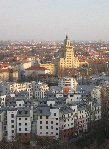
The tall building behind the ‘Residence Podbaba’ flats development is a wonderful example of the architectural style usually known as ‘Stalinist Baroque’.  It is based on the design of Moscow University and was originally built during the communist era, as a hotel for visiting senior military personnel from Warsaw Pact countries. These days it functions in a more capitalist manner as the Austrian owned ‘Crowne Plaza Hotel’. However, Sybille always refers to the star on the pinnacle of the tower as the ‘Star of Stalingrad’!

Podbaba Lock with the Hydrological Station and sewage works © Ricky Yates

The end of the Baba ridge directly overlooks the Vltava River which runs through the centre of Prague. As I have written previously, the River Vltava is navigable from where it leaves the Labe/Elbe at Melnik, all the way to Prague and onwards to the Slapy Dam. This picture shows Podbaba Lock with Hydrolologický Ústav (the Hydrological Station) in front of it and Prague’s main sewage works behind. Amazingly, we have never experienced any foul smells despite the sewage works being in such close proximity.

View across Prague from the Baba ridge © Ricky Yates

This next photograph shows the view looking towards the centre of Prague. In the foreground is ‘Residence Podbaba’ with part of the orangey-red patch just visible on the right. In the middle-distance left is the distinctive tower of the Crowne Plaza Hotel. In the far distance on the left is St. Vitus Cathedral which lies within the walls of Prague Castle. On the right in the far distance, is Petrin Hill, with a smaller version of the Eiffel Tower on top.

Not only does the Baba ridge provide wonderful views across Prague, it is also the location of a fascinating model housing exhibition dating from the early 1930s. The construction of the Baba Ideal Housing Estate, as with similar ones in Vienna and Budapest, was inspired by the success of the Weissenhofsiedlung, a housing exhibition that had been mounted by the Deutsche Werkbund (German Work Federation) in Stuttgart in 1927. The Werkbund was a group of enterprising architects and designers founded in Munich in 1907 by Hermann Muthesius. Somewhat similar to the Viennese Wiener Werkstätte and the English Arts and Crafts Movement in their production of quality products, they differed in being unopposed to reaping the financial rewards made possible through industrial mass production.

In September 1932 the Czech Werksbund mounted their own model housing exhibition under the guidance of the Modernist architect and town planner Pavel Janák. They selected the Baba ridge as the location for their exhibition and thirty three houses, by a variety of architects, were erected. Set side-by-side so their qualities could be judged comparatively, they are strung out along the sloping terrain so as to maximise the view from each building. The houses were individually and specifically designed to provide simple, and affordable yet innovative living spaces for ordinary families.

Bauhaus-style house © Ricky Yates

Meant to be only temporary, the geometric Bauhaus-style houses, which still appear modern today, were ultimately bought up by the Czech avant-garde, having proved too expensive for the original target market. In more recent times, many have been divided into two or three flats.

Bauhaus-style house © Ricky Yates
Bauhaus-style house in need of some renovation © Ricky Yates

Whilst most of these architectural gems are in good order, a small number are in need of rescue and renovation. This one is an example of one that could do with a little bit of tender, loving care.

A ferry across the Vltava

Ferry boat moored at the ferry terminal at Podbaba © Ricky Yates

I’ve written previously about the wonderful integrated public transport system here in Prague. It consists of buses, trams and the metro. They do all interconnect and allow access to every part of the city. Not only are services frequent and reliable, unlike in the UK, they don’t stop functioning as soon as it snows!

And travel on the whole system is so remarkably cheap. Sybille and I both buy an annual season ticket. The Chaplaincy kindly pay for mine. Each annual season ticket costs 4750 Kc which at current exchange rates is about £168.00. A combination of this great value, together with the extreme winter weather which has only recently finally relented, may explain why I haven’t put petrol in my car since December 2009!

Ferry crossing the Vltava © Ricky Yates

However, not only does the integrated public transport system include buses, trams and the metro, it also includes three little passenger ferries across the River Vltava. Two of these lie relatively close to where we live and help overcome the fact that there is no road bridge across the river after Most Baríkádníku just north of the city centre at Holešovice, until the town of Kralupy, many kilometres further north of Prague.

One ferry terminus on our side of the River Vltava, is just a short walk or two stops on the bus from the Chaplaincy flat. It goes across to Podhori on the other side from where it is only a further short walk to one of Sybille’s favourite places to visit – Prague Zoo. Last month, I crossed to river on the ferry and caught the connecting bus on the other side, in order to travel on to the hospital in Bohnice to make a pastoral visit to one of the congregation. The journey took no more than twenty minutes. Not using the ferry, it would have taken nearly an hour.

Despite being rather small, not only are foot passenger transported across the river by ferry, but also bicycles and children in pushchairs and buggies.

Ferry crosing the Vltava, seen from the Baba ridge with the paneláks of Bohnice on the opposite hillside © Ricky Yates

A Trip up the River Vltava

Dam and  Hydro-electric plant on the Vltava at Vrané © Ricky Yates
Dam and Hydro-electric plant on the Vltava at Vrané © Ricky Yates

As most people who know me will already be aware, I have had a lifelong interest in canals and inland waterways. I was therefore delighted to discover that the Vltava, the river on which Prague is situated, is navigable. Engineering works, begun in the nineteenth century, have provided locks, navigable cuts and a sufficient depth of water to allow quite sizeable craft to reach the city.

The Vltava (or Moldau in German) leaves the Labe (Elbe in German) at Melnik, about 50 km north of Prague. From Melnik, it is possible to travel downstream along the Labe/Elbe all the way to the North Sea at Hamburg as well as connecting with canals and rivers that lead to Berlin and other German cities. Upstream of Melnik, the Labe is also navigable as far as the Czech city of Pardubice.

Not only is the Vltava navigable, it still carries quite a considerable amount of commercial traffic as far as Prague. From my observations, this mainly consists of bulky materials such as sand and gravel. The use of river transport in this way saves the surrounding roads from a large number of additional truck journeys which would otherwise be required to shift these goods.

In the centre of Prague, the Vltava is populated by many passenger vessels offering tourists trips along the river to view the city sights or to enjoy a meal in a floating restaurant. Most of these vessels rarely pass a lock, confining themselves to the section of the river between Hlávkuv most (just east of St. Clement’s Church) and to just south of Karluv most (Charles Bridge). However, a few months ago, I was delighted to discover that one company does offer a far longer trip upstream on the Vltava, all the way to the head of navigation at Slapy, nearly 40 km south of Prague city centre.

Pražská Paroplavební Spolecnost only run this trip on Saturdays and Sundays between early May and mid September. As Sundays are out because of my profession, if I was going to make the trip this summer, it was going to have to be on a Saturday. And having my sister Jenny staying with us for ten days recently gave me the perfect excuse. Here was a day out that we would both enjoy! So having for once, completed the Sunday sermon on Friday, on Saturday 15th August we set out early from the flat, travelled by bus and metro to Palackého námestí, bought our tickets from the office on the quayside, all ready for our departure upstream at 9am.

The boat was smaller than I was expecting and was quite packed with standing room only. However, so far as I was aware, Jenny and I were the only non-Czechs on board. This trip clearly appeals to Czech people who want to head out of Prague into the surrounding countryside but clearly doesn’t normally appear on the agenda of visiting foreign tourists.

Small pleasure boats entering lock at Vrane © Ricky Yates
Small pleasure boats entering lock at Vrané © Ricky Yates

The initial part of the journey out of Prague goes past the Staropramen Brewery on one side of the river and the twin spires of the Church of St. Peter & St.Paul at Vyšehrad on the other. Then follows the southern suburbs of the city, together with passing our first lock at Modrany. Soon afterwards comes the confluence of the River Berounka and then the Vltava enters an ever increasingly beautiful wooded valley at Zbraslav.

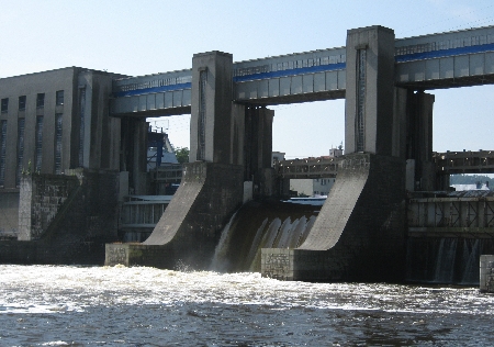
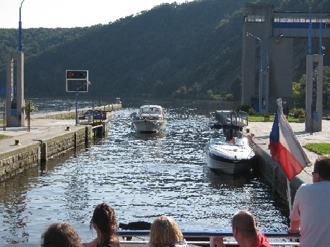
About 5 km further on lies the next lock at Vrané. This is situated at one side of a fairly substantial dam built across the river to generate hydro-electric power. Beyond this dam and lock, the river is wider because it is effectively a ribbon lake.

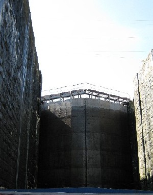
Inside Štechovice Lock © Ricky Yates
Lower gates of Štechovice Lock © Ricky Yates

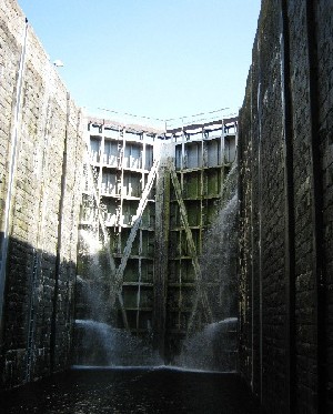
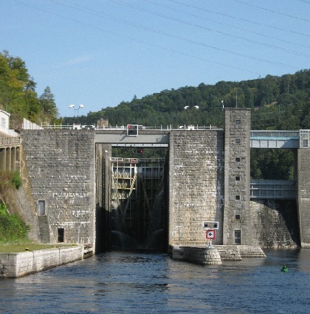
After cruising for over three hours and nearly 30 km, we arrived at the town of Štechovice. Here passengers both got off and on before we set out on the final leg of the journey. Ahead lay a much higher dam, also generating hydro-electricity, and therefore with a far deeper lock alongside. In fact the lock is monstrous – certainly the deepest lock I’ve ever passed through. The mind boggles as to how much water it takes to fill it! But eventually, our boat rose out of the bowels of the lock for a further forty minutes of cruising past beautiful wooded hills until we reached journeys end, the quay at Nové Trebenice, immediately below the very impressive Slapy Dam.

Štechovice Lock © Ricky Yates

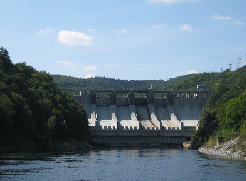
The Slapy Dam was built during the Communist era between 1949 – 1955. Like the earlier smaller dams we passed, it also enables the generation of hydro-electricity as well as helping to control the river flow, hopefully helping to prevent flooding further downstream during times of heavy rainfall. But for unknown reasons, no lock or boat lift was provided when it was built and the dam therefore prevents through navigation. The lake behind the dam is extremely popular with small yachts and pleasure boats. But none of them can cruise down the river to Prague because the Slapy Dam blocks the way.

After a quick lunch at a bar-restaurant in Nové Trebenice and a walk out on top of the dam, it was back to the boat for the return journey. This was fortunately less crowded as a number of people only did the journey one-way and got the bus back to Prague. It thus enabled me to more easily take the photographs that accompany this post. We arrived back at the quay alongside Palackého námestí at 6.30pm somewhat tired and a little sunburnt but having had a most enjoyable day.

Slapy Dam © Ricky Yates